Starlink is a constellation of 7,078 (as of 01.03.2025) satellites in low earth orbit that provide internet services worldwide, especially in remote areas. The first satellites were launched in 2019 and the constellation continues to grow to this day. It is not clear how many operational units the owner (Starlink Services LLC) intends to put into operation in the end; it is possible that there will be more than 30.000.
Since the beginning of the project, 4 generations of Starlink satellites have been developed. These satellites are launched in groups. As the satellites of the first generation were smaller, groups of around 60 could be sent to space with the launch of a single Falcon 9 rocket. The 4th generation (“v2 mini”), which are currently being launched (April 2025), are larger, meaning that only just over 20 are put into orbit with per launch with the same rocket.
The Starlink satellites of one group are deployed by the launch vehicle on a very low orbit of about 300 km. Initially all satellites are very close to each other like pearls in a pearl chain but over the following days, weeks and months they separate more and more along the orbit as they increase their altitude by their own ion thrusters to a final height of about 550 km. This orbital raise takes 1,5 to 4 month and not all satellites of a group start with this manoeuvre at the same time. As soon as the satellites have reached their final orbital altitude, they are integrated into the overall constellation.
A chain of newly launched Starlink satellites is also known as a “train”, as from the ground it gives the impression of a train made up of many wagons lined up next to each other. Over time and with increasing mutual separation of the satellites, this impression disappears.
Starlink satellites are heavily criticized by astronomers. Satellites are visible from the ground at night when they are still illuminated by the sun in their orbit. Due to the sheer number of Starlink satellites and their high brightness, this interferes with astronomical observations. The company has responded by taking measures to ensure that newer generations of satellites in operational orbit reflect less light.
Movie of a Starlink train
Starlink train on 08.06.2024 around 23:00 UTC over Wiesbaden. While the new v2.0 mini-satellites are no longer visible to the naked eye at their operational altitude, there is obviously still a chance of an impressive sighting with the naked eye while the satellites are still on their way to their final orbit shortly after launch.
The movie starts on 08.06.2024 at 22:59:35,0 UTC and ends at 23:01:38,4 UTC. Local time was +2 hours. The movie has a length of 14,84s for a time span of 86,32s, so the time compression is 5.8x.
The satellites shown here are Starlink Group 10-1 (launch number 172), which were launched from Cape Canaveral at 01:56 UTC on the morning of the same day to an orbit with 53° inclination (the orbital plane is tilted by 53° to the equator, so the satellites pass all regions between 53°S and 53°N). The launch vehicle deploys the satellites on a very low orbit of around 290 km., which is approximately where they were at the time of filming. At such a low altitude, the satellites would burn up in the atmosphere after just a few days due to air drag. This is why they raise their orbit to a more stable altitude of around 500 km with the help of their own ion thrusters. This makes sure that if a satellite does not function properly it leaves the orbit very soon without further action and therefore does not contribute to the large amount of space debris.
The trailing satellites are much brighter than the leading ones. The reason for this is most likely a different spatial orientation: the trailing satellites are oriented such that they reflect more sunlight. The sun was almost in the north, 17° below the horizon. For the observer this meant night but for the satellites the sun was above the horizon.
If you watch the movie in higher resolution, you will see many more satellites. As the sun is not very far below the horizon at 50°N in summer, you can see satellites all night long at this time of year. Even those in very low orbits are still illuminated by the sun.
As a rule, low-flying satellites are brighter than those on high orbits. However, even geostationary (36.000 km altitude bove the equator) satellites can sometimes be seen with the naked eye if a specular reflection of the sun occurs. Diffuse reflections are always significantly weaker. If you see a bright star that does not move noticeably for a few minutes and which suddenly disappears, then this it is not necessarily an extraterrestrial spaceship.
Another group of Starlink satellites
The movie had shown a real train because the satellites were launched only 21 hours previously.
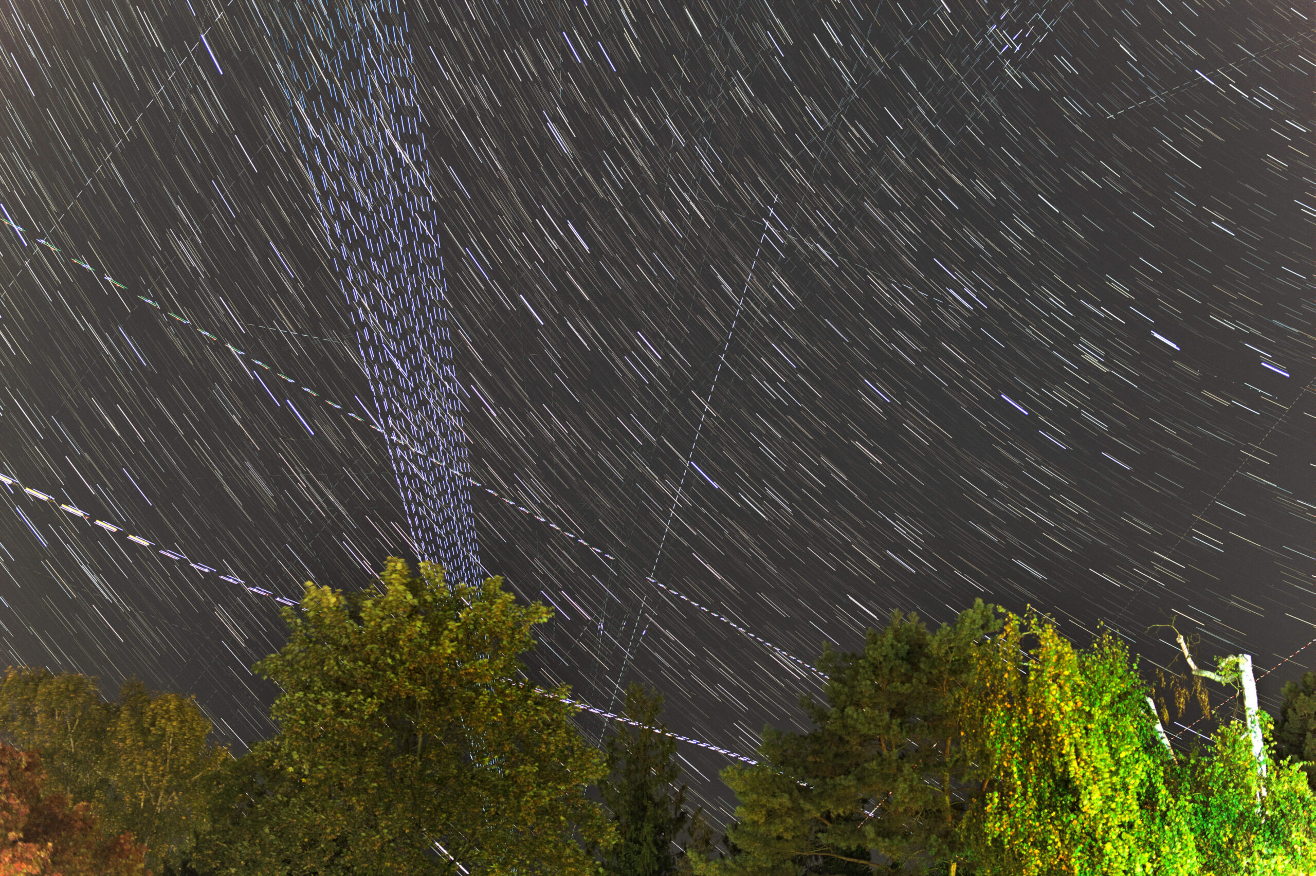
The picture above is a different way to depict a group of Starlink satellites (Starlink Group 6-21, launched on 05.10.2025, orbital inclination 43°, launch number 111). The launch ocurred 10 days earlier so the satellites no longer form a train but still are quite close to each other. What you see in a single image is the result of a maximum-intensity projection1 of 279 single exposures, each of 1s duration, taken on 15.10.2023 from 18:27:42 until 18:35:33 UTC. That’s a total duration of 471s in which the camera exposed for 279s, so there was an interval of approximately 0,7s between each exposure (between image 248 and 249 the interval was a 6 seconds!). Hence, 10 days after launch, the satellites had alteady moved so far apart that it took 8 minutes to capture all of them in one image.
The diagonally orientated and slightly curved lines are stars. As earth rotates very slowly each exposure of a star resulted in a dot. These 279 dots are so close to each other that they overlap to continuous lines. All the many dashed, straight lines on the other hand are satellites that moved much faster than the stars, so the intervals are clearly visible (three lines can be identified as aeroplanes: they consist of closely spaced dashed lines and coloured dots from the aeroplane’s positional lights). The Starlink satellites are the very prominent 21 bright dashed lines that fan out from bottom to top.
It is unknown to me how high the satellites of the depicted group were but is must have been somewhere between 300 and 350 km at most.
As almost all satellites are launched in an easterly direction to take advantage of the speed of the Earth’s rotation, and the view in this image is to the northwest, the Starlink satellites rose from the horizon and moved upwards. Each line shows the movement of a satellite within 1 second. The Starlink satellites move in circular orbits around the Earth, and on a circular orbit the speed of a satellite is the same at any point. It is only the distance effect that makes the dashes appear longer as they rise above the horizon and get closer to the observer.
If the Earth had not rotated during the 8 minutes in which the images were taken, all 21 satellites would have followed the same path and the image would show a single bright line consisting of all the many overlapping dashes. Instead, we see 21 dashed lines that are offset from each other. However, the offset is not equal. The two satellites furthest to the left are separated by a very small distance, which means that they followed each other very closely. Those further away from each other had a greater distance between them. The reason why the 21 lines fan out towards the top is simply due to the perspective. Just like the lanes of a highway widen from the distance to the front.
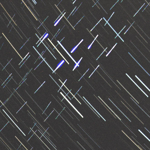
Look at the dashes at the top of the image:

Here they faint out and change their colour to something more bluish. Why does this happen? Well, we see these satellites because they are still illuminated by the sun. At one point the sun also sets from the elevated position of a satellite. And this can be seen in the appearance of the dashes when they get dimmer and their colour changes. This happens at a position higher above the horizon of the observer for the satellites on the right as they were captured first at a time where the sun was higher at their altitude. The satellites to the left came later when the sun had sunken deeper so they see their “dusk” at a lower altitude above the observer’s horizon.
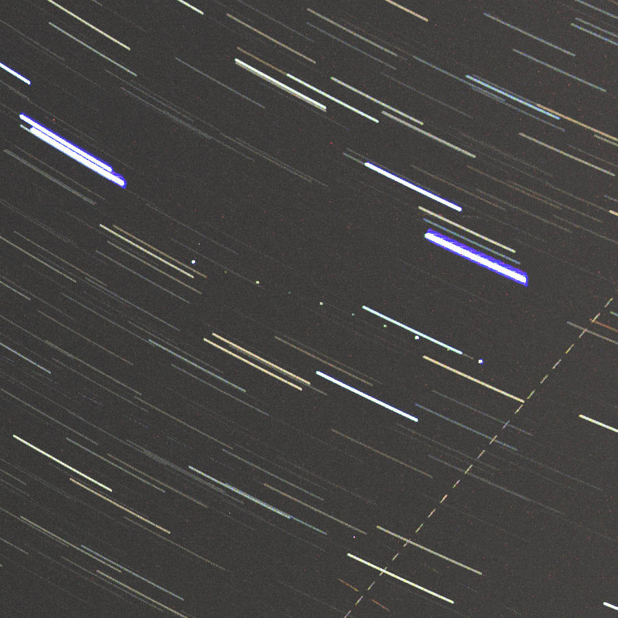
The dashes of some satellites (e.g. top right in the full image) are initially quite faint, but then become increasingly brighter, reach a sudden maximum at one point, after which they become fainter again.
The reason for this is that as the satellites move, part of their surface, which reflects like a mirror, gets into a position where it directs the sunlight directly at the observer (so-called specular reflection). Since this happens with all these satellites at the same position, we can assume that these satellites are firstly built identically and secondly have a certain spatial orientation, from which we can conclude that they are functional. Due to such reflections, it is not unusual for a satellite to be visible for only a few seconds. Sometimes a satellite that is normally too faint to be seen with the eye causes only a brief visible flash.
On the right image corner of the full image, halfway between top and bottom, you may notice a group of 10 dots:
these are the result of a very high orbiting satellite that rotated in a way, that 10 times for a short time the specular reflection of the sun made it visible while in between the device was too dim to be seen by the ground level of diffuse reflection.
- All images (x/y dimension) in a series are virtually stacked on top of each other (z dimension). Along each pixel column (along the z axis), only the pixel with the highest intensity value is now used for display. ↩︎